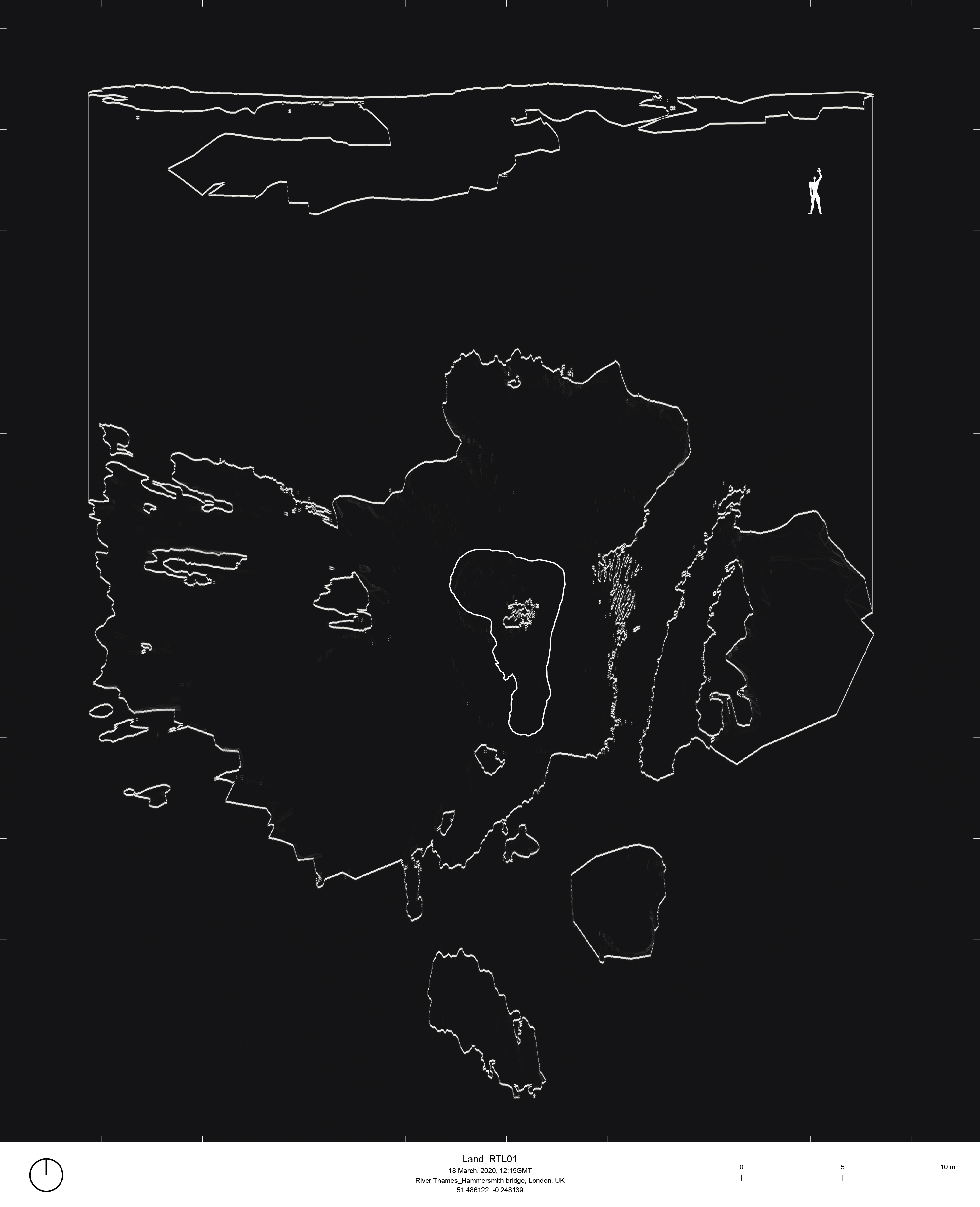
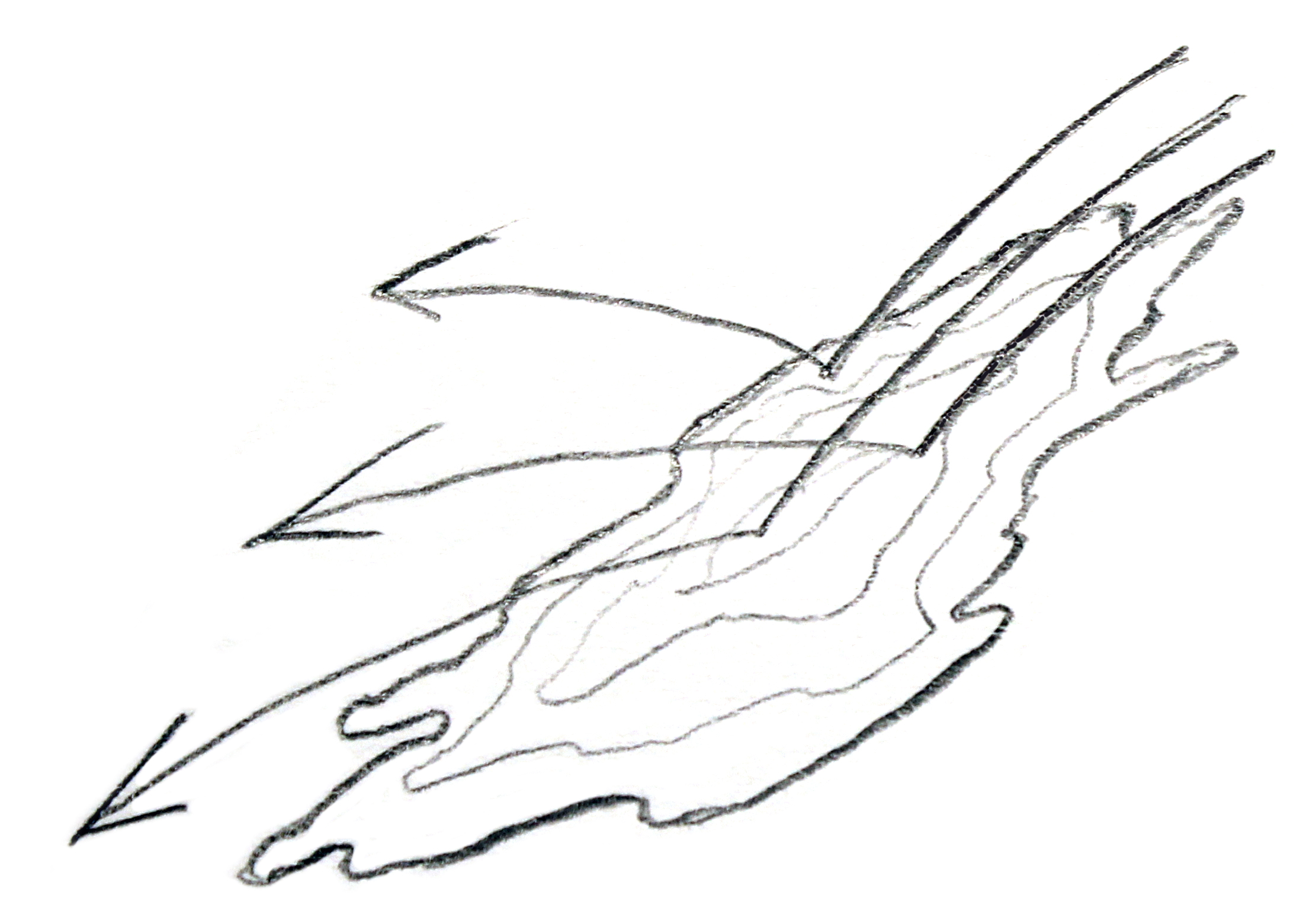
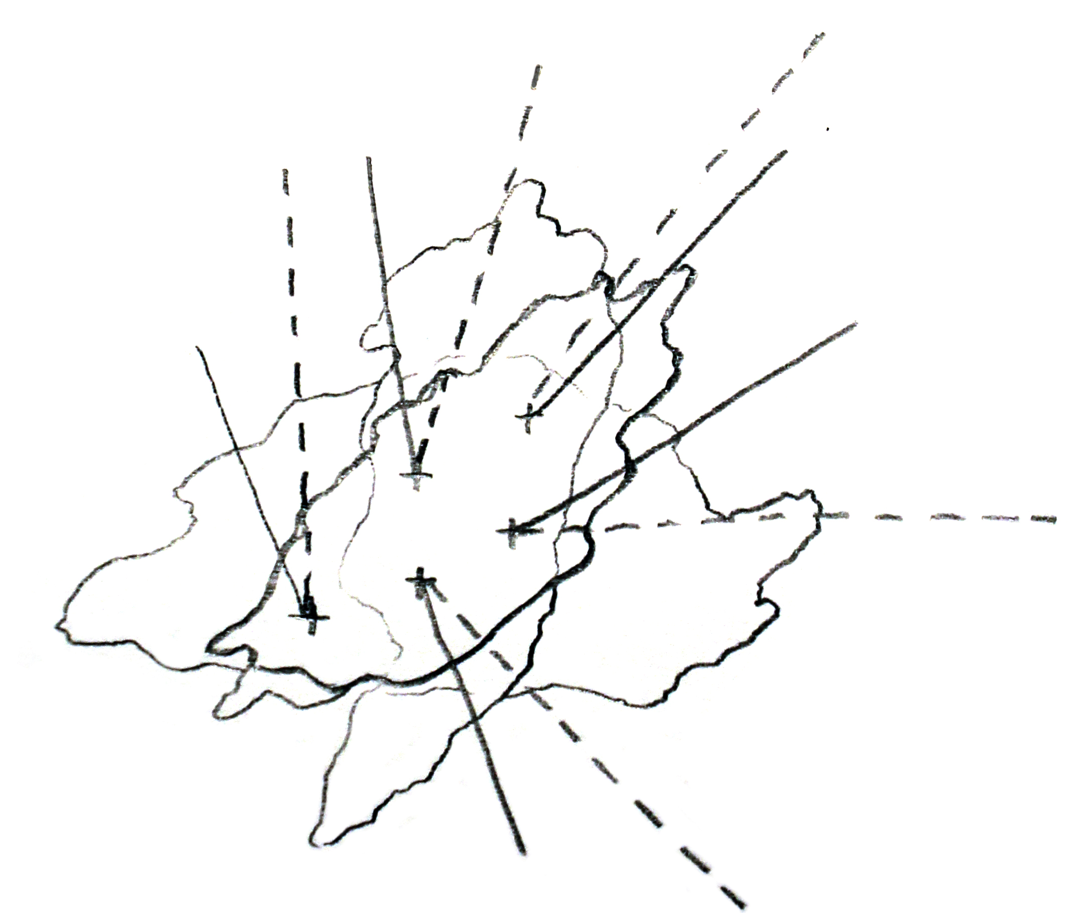
Hidden Island
Archival 3D scanned model | 12:19-16:58 GMT, 18 March, 2020
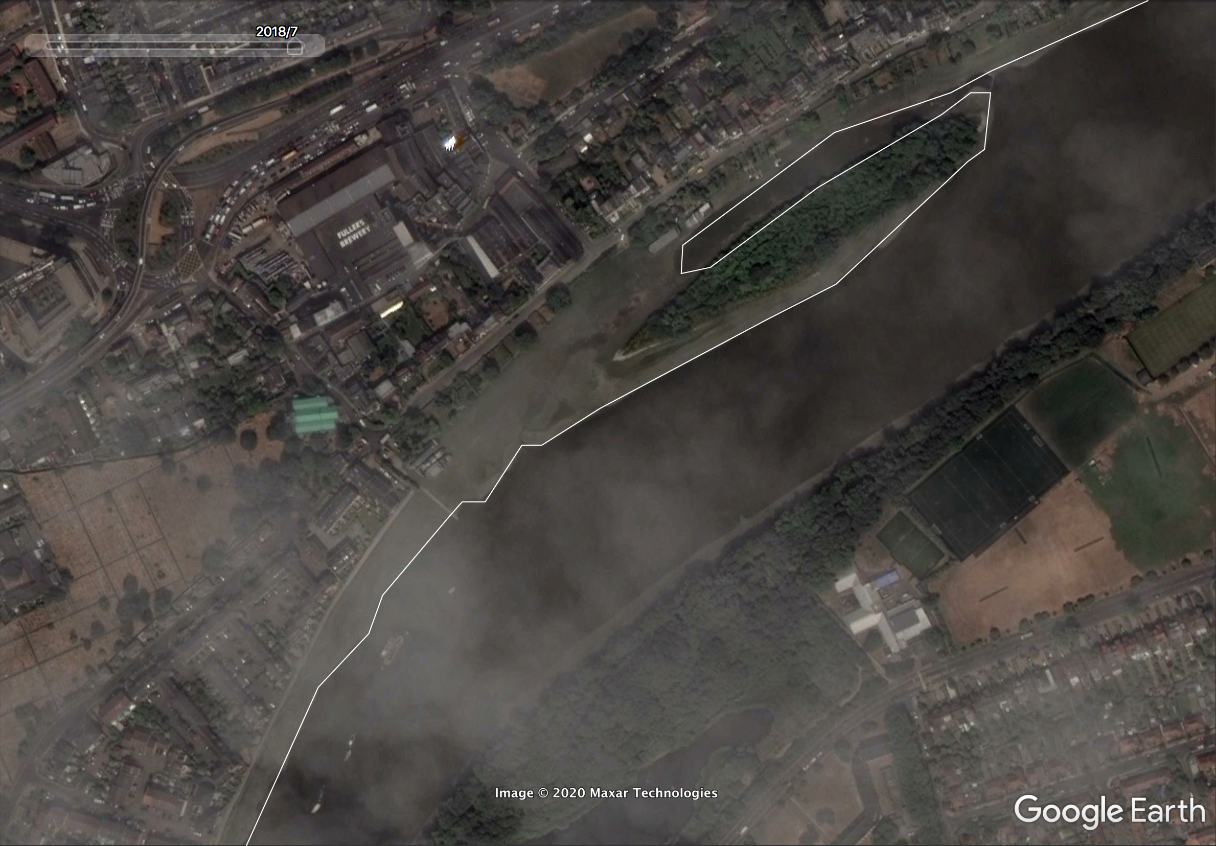
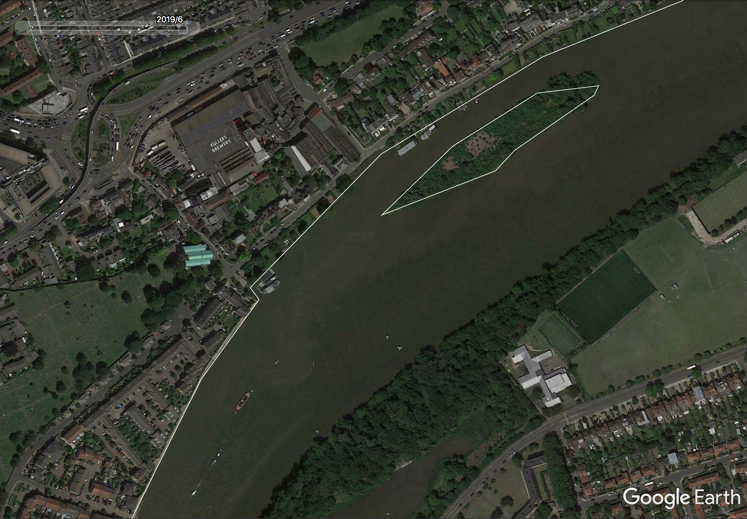
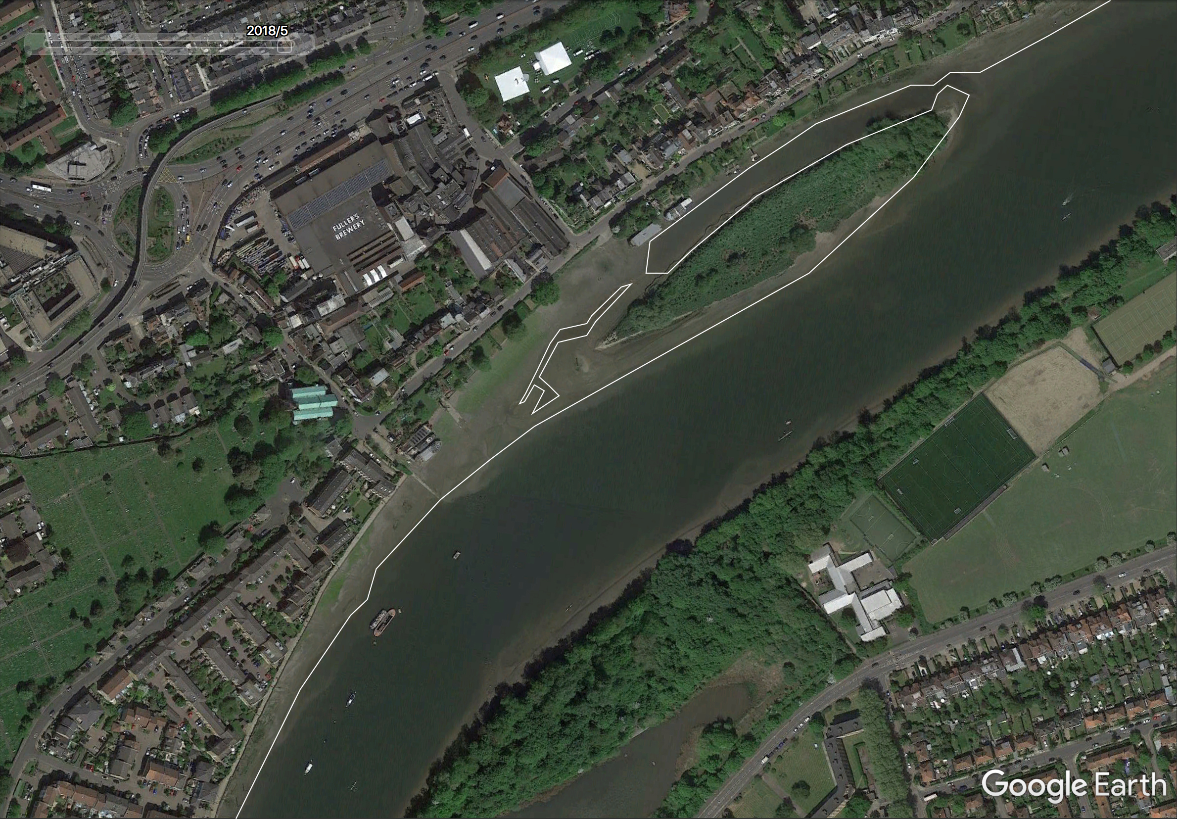
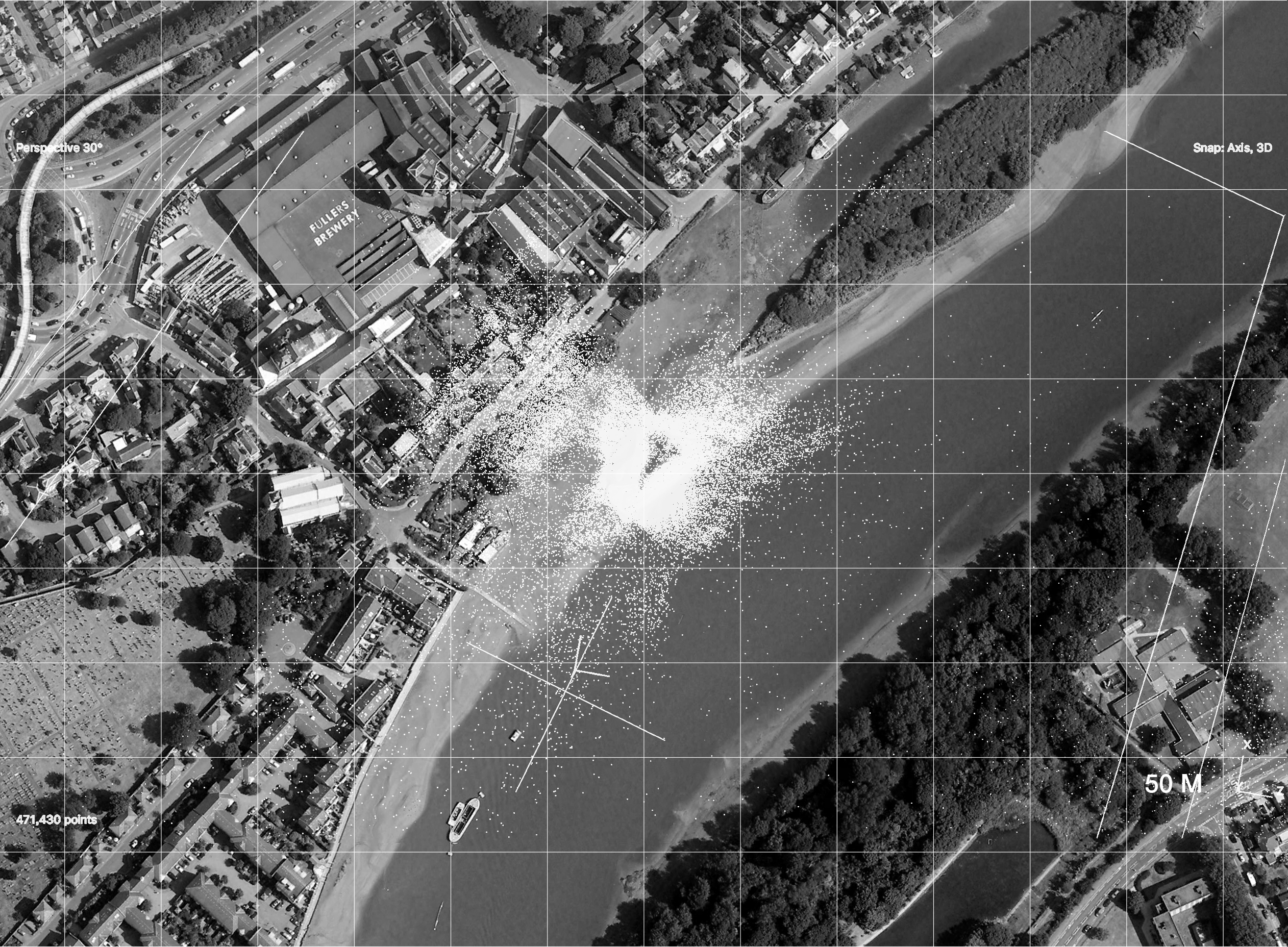
River Thames (Hammersmith Bridge), London, UK
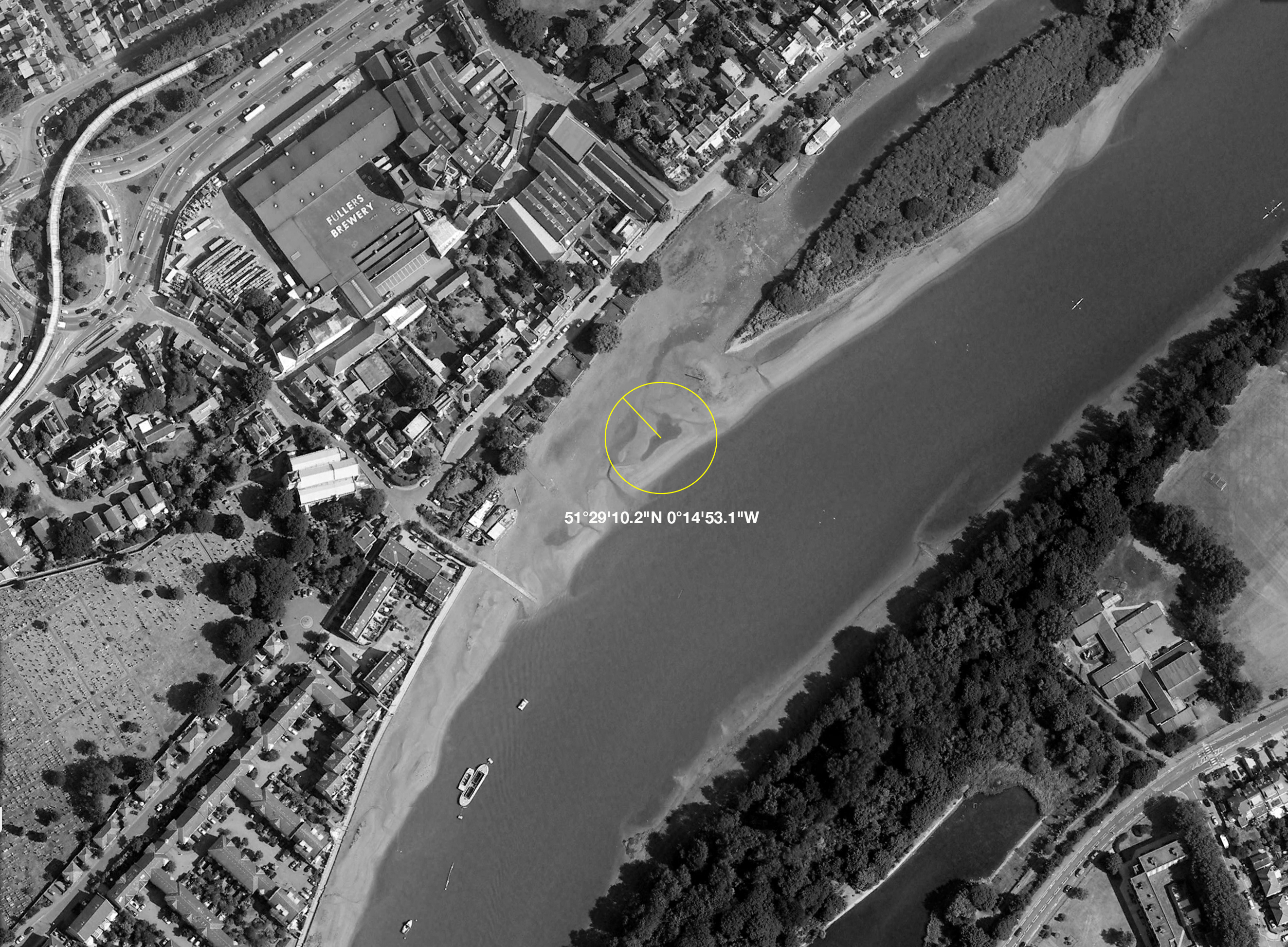
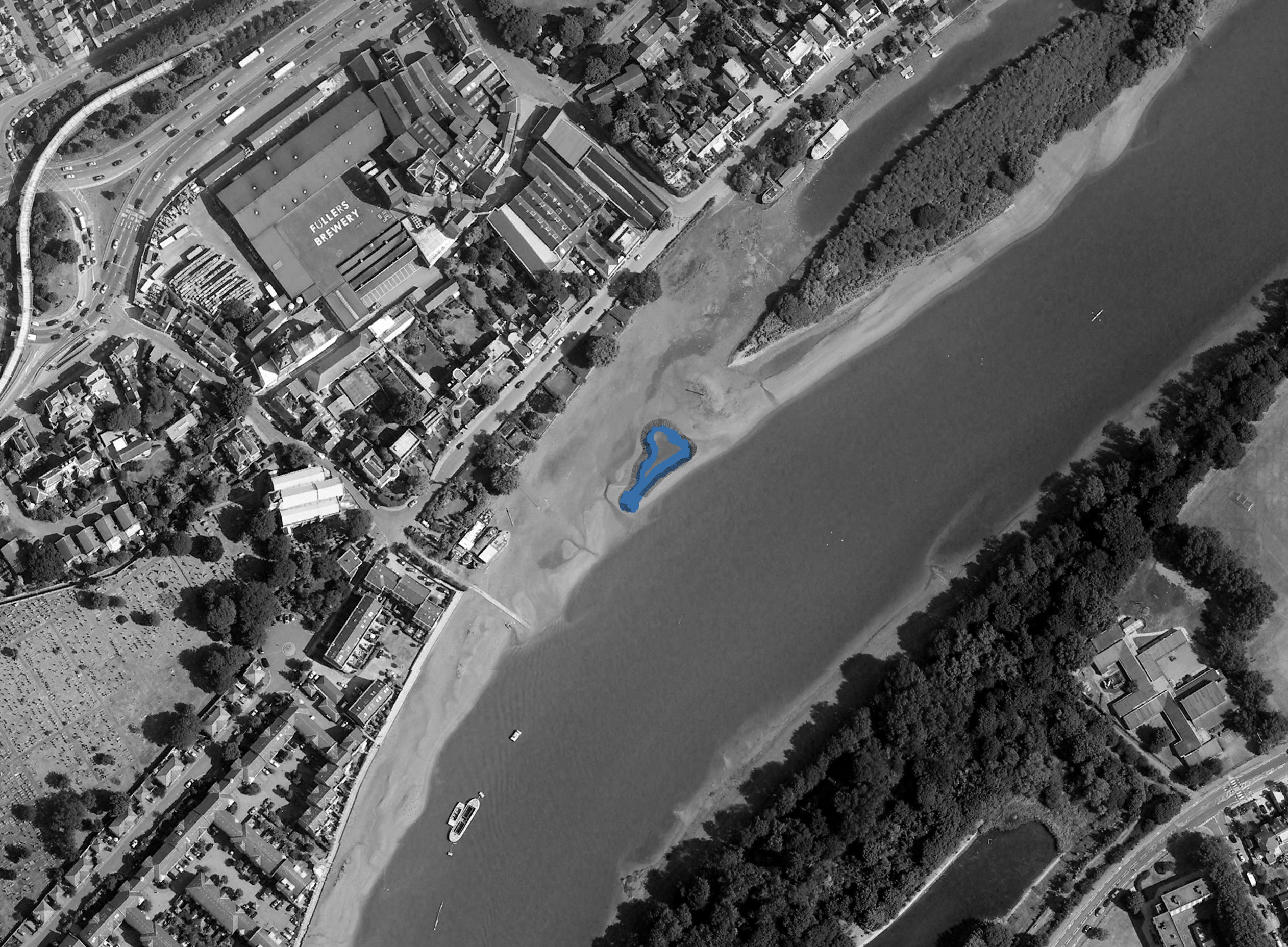
51°29'10.2"N 0°14'53.1"W
2020
River Thames (Hammersmith Bridge), London, UK
51°29'10.2"N 0°14'53.1"W
2020

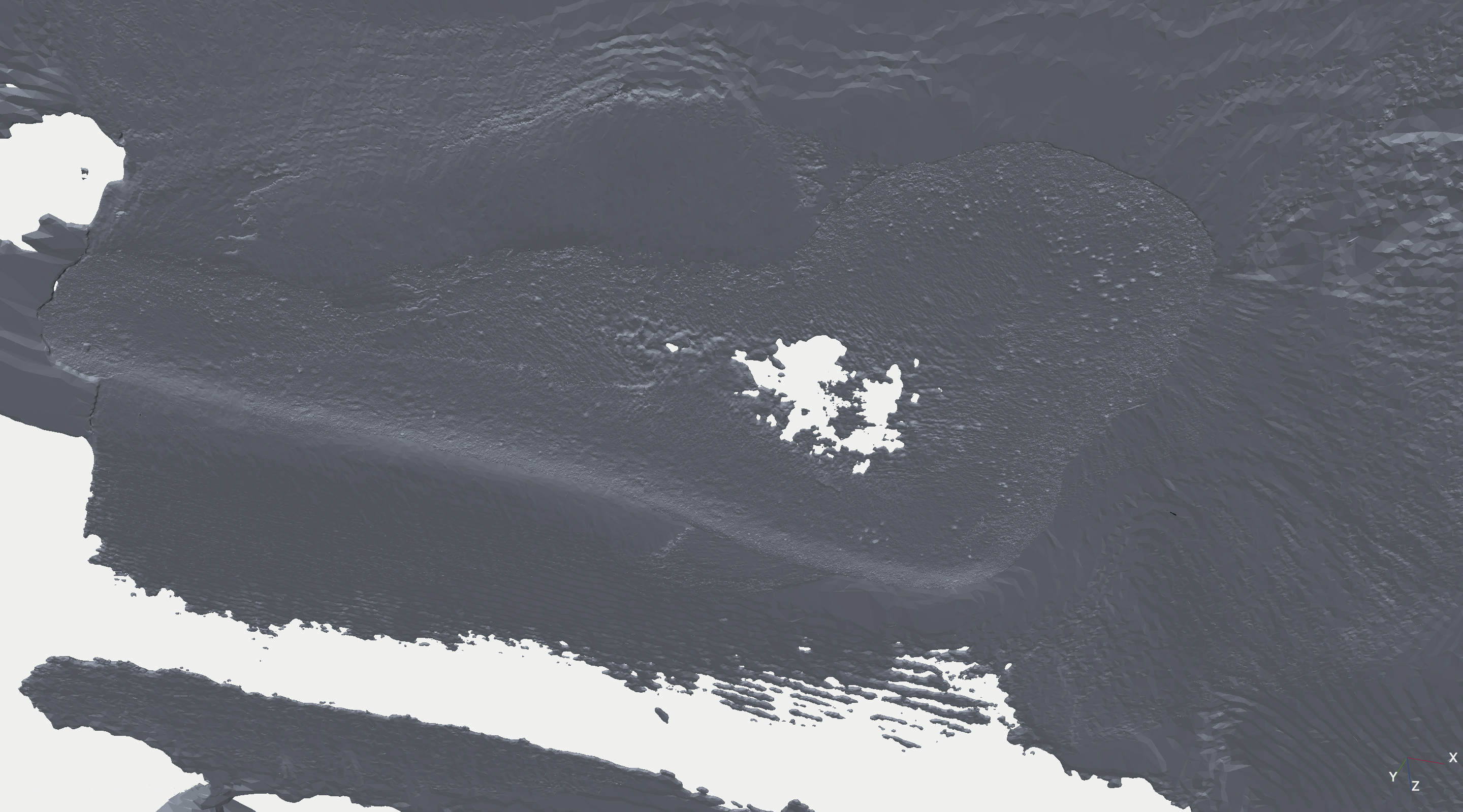
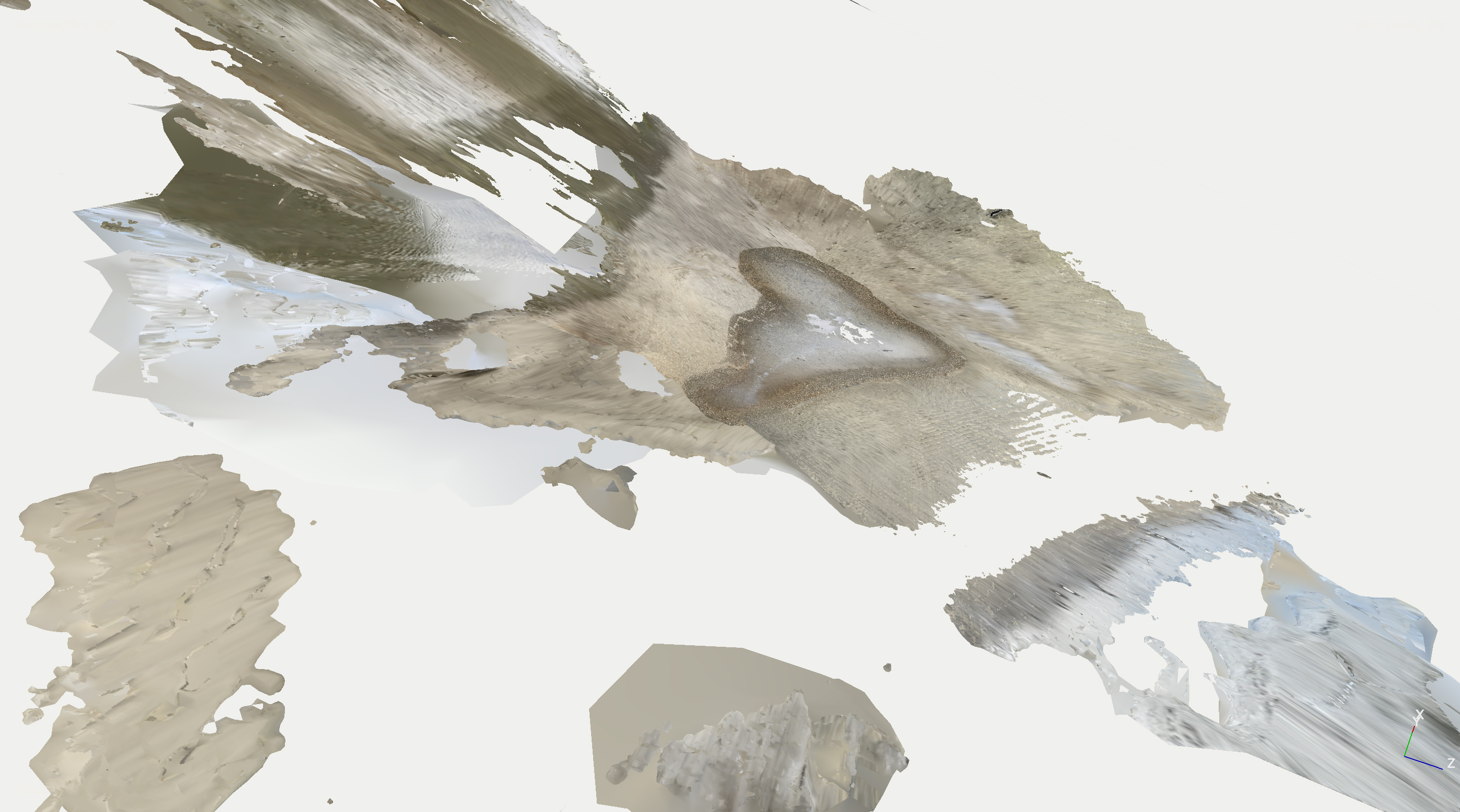
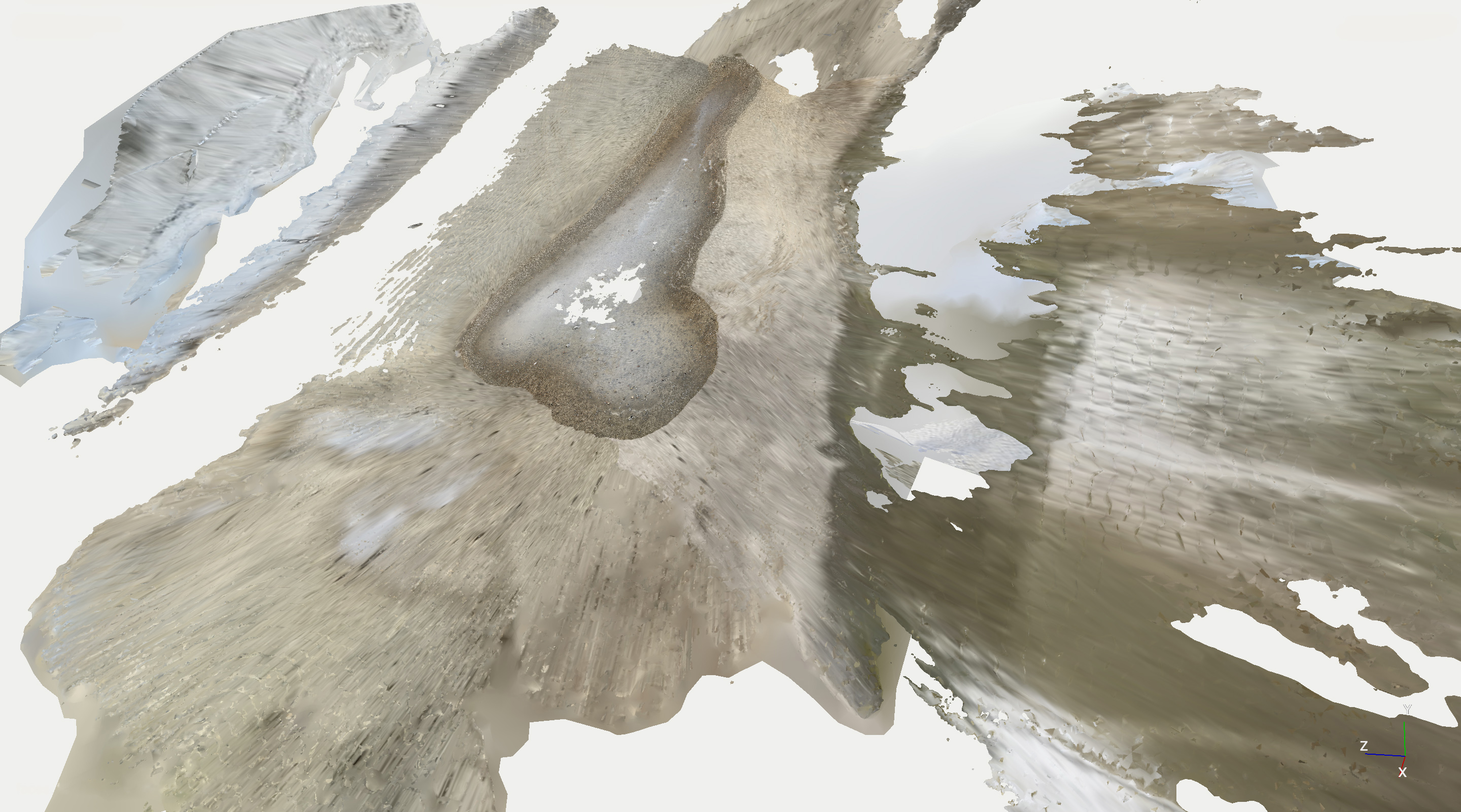
Tides are temporal and environmental phenomena shaped by the combined gravitational forces of the Moon and the Sun, as well as the rotation of the Earth. During my observation along the River Thames in March 2020, the tidal cycle lasted approximately 4 hours and 17 minutes. This duration is shorter than the minimum temporal scale within which orbiting satellites can accurately document the river’s continuously shifting ebb and flow, along with the changing contours of its banks.
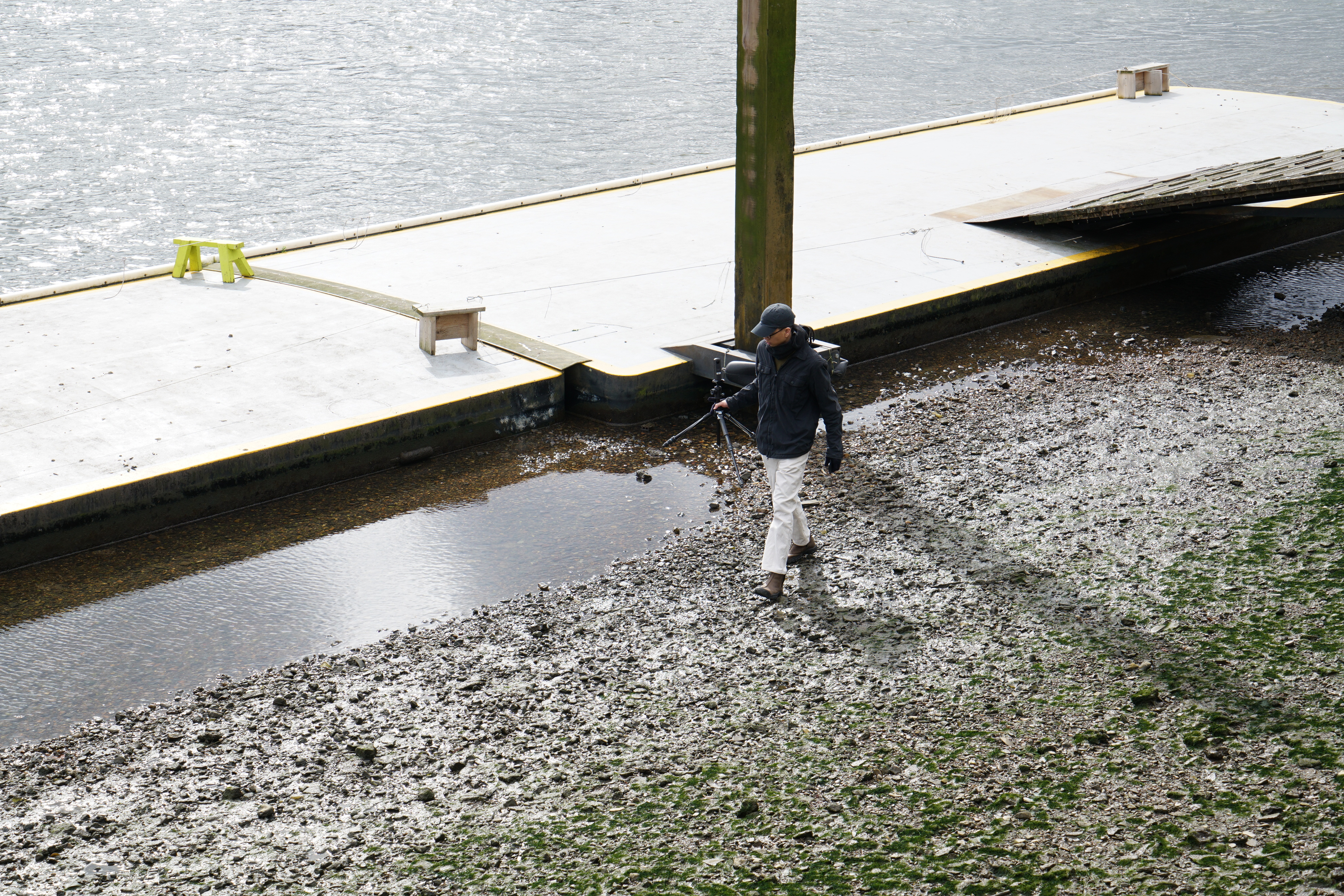
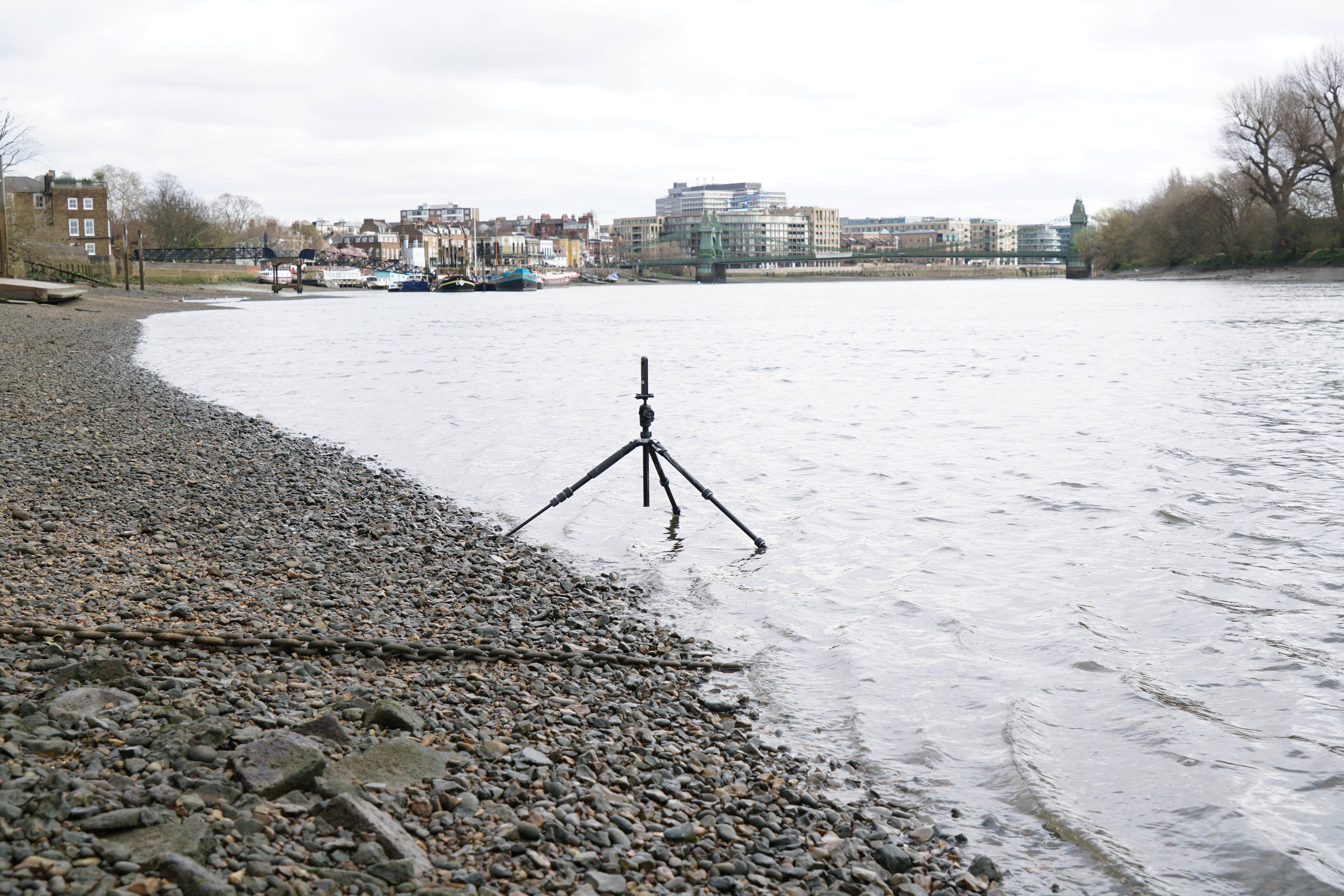
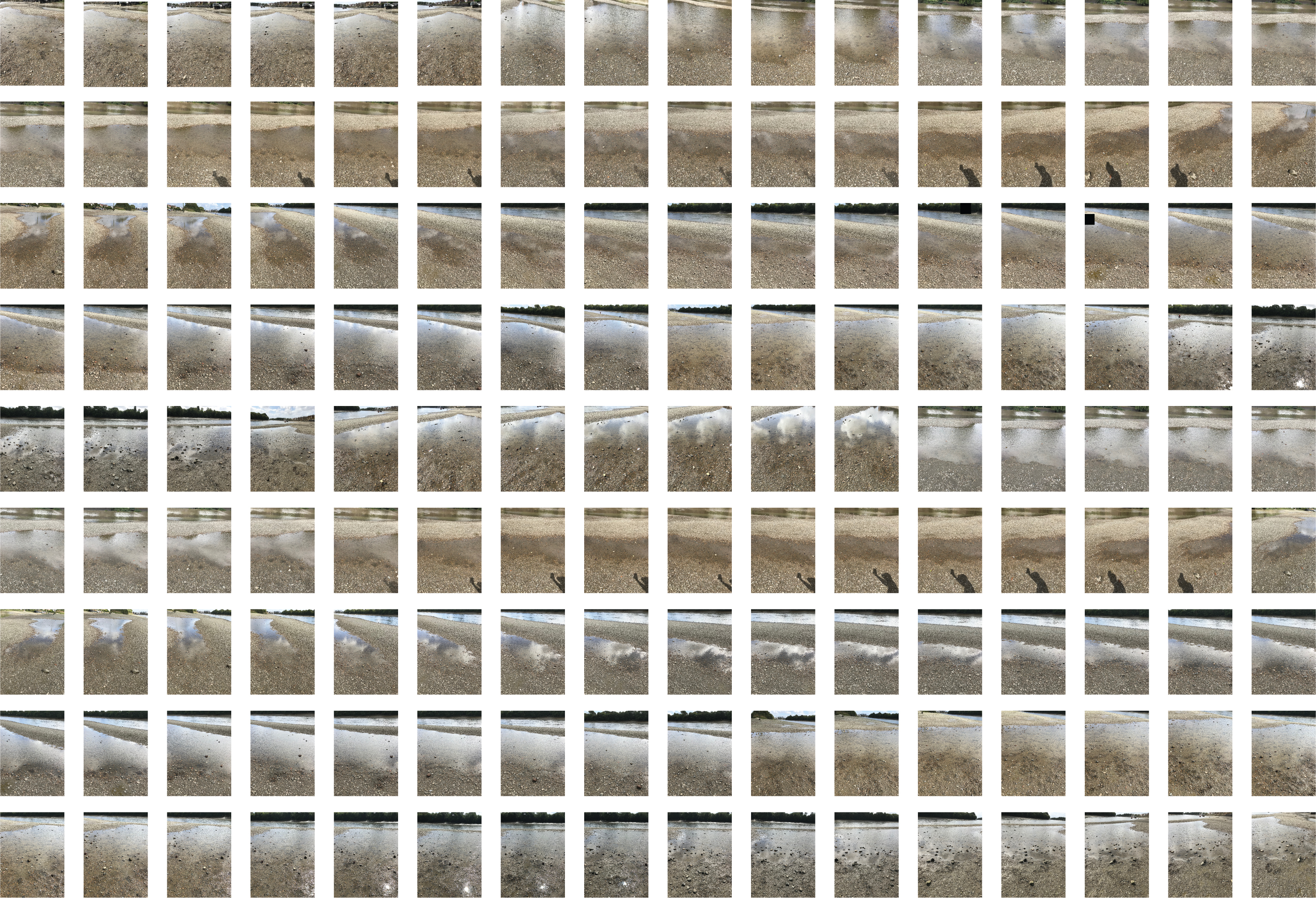
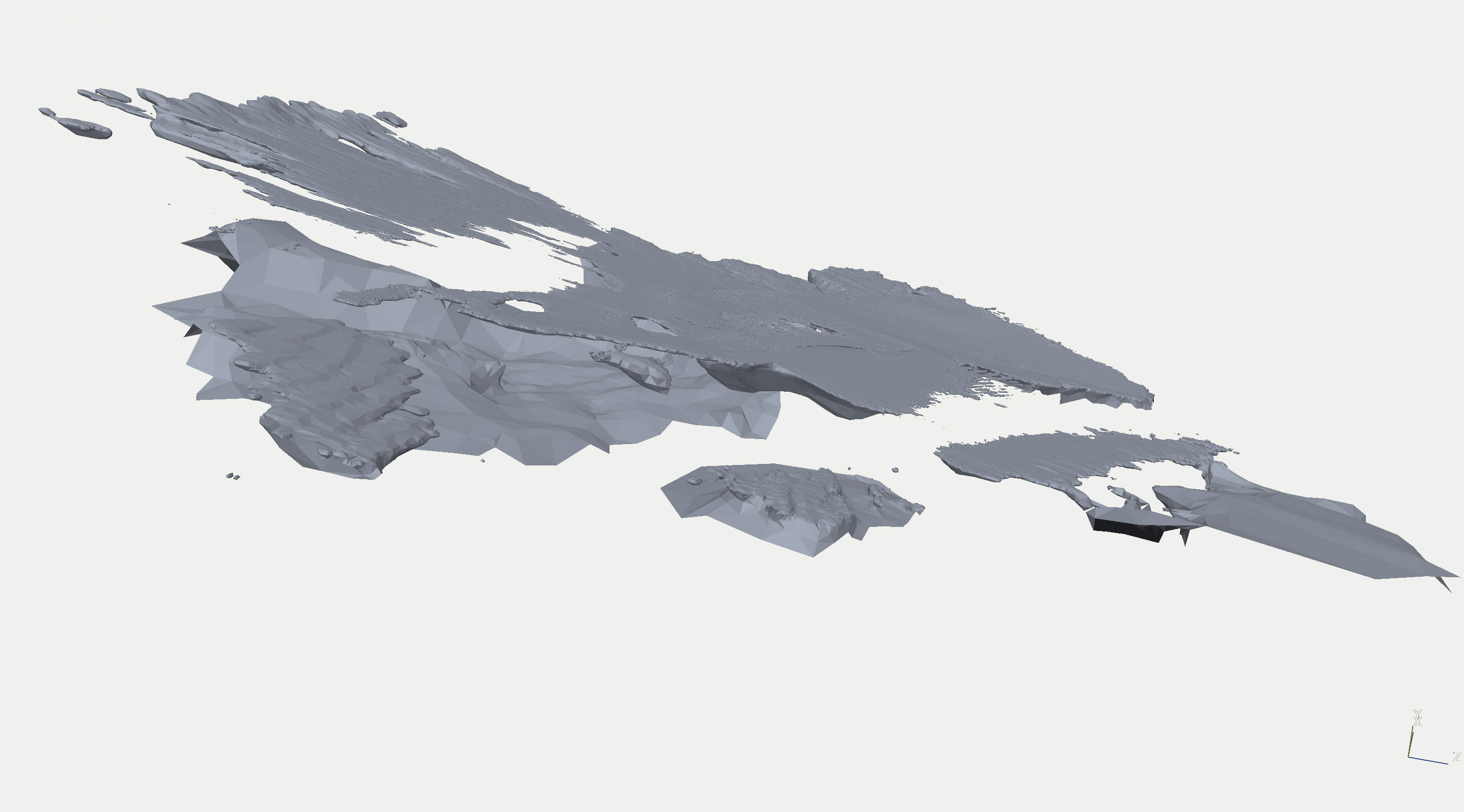
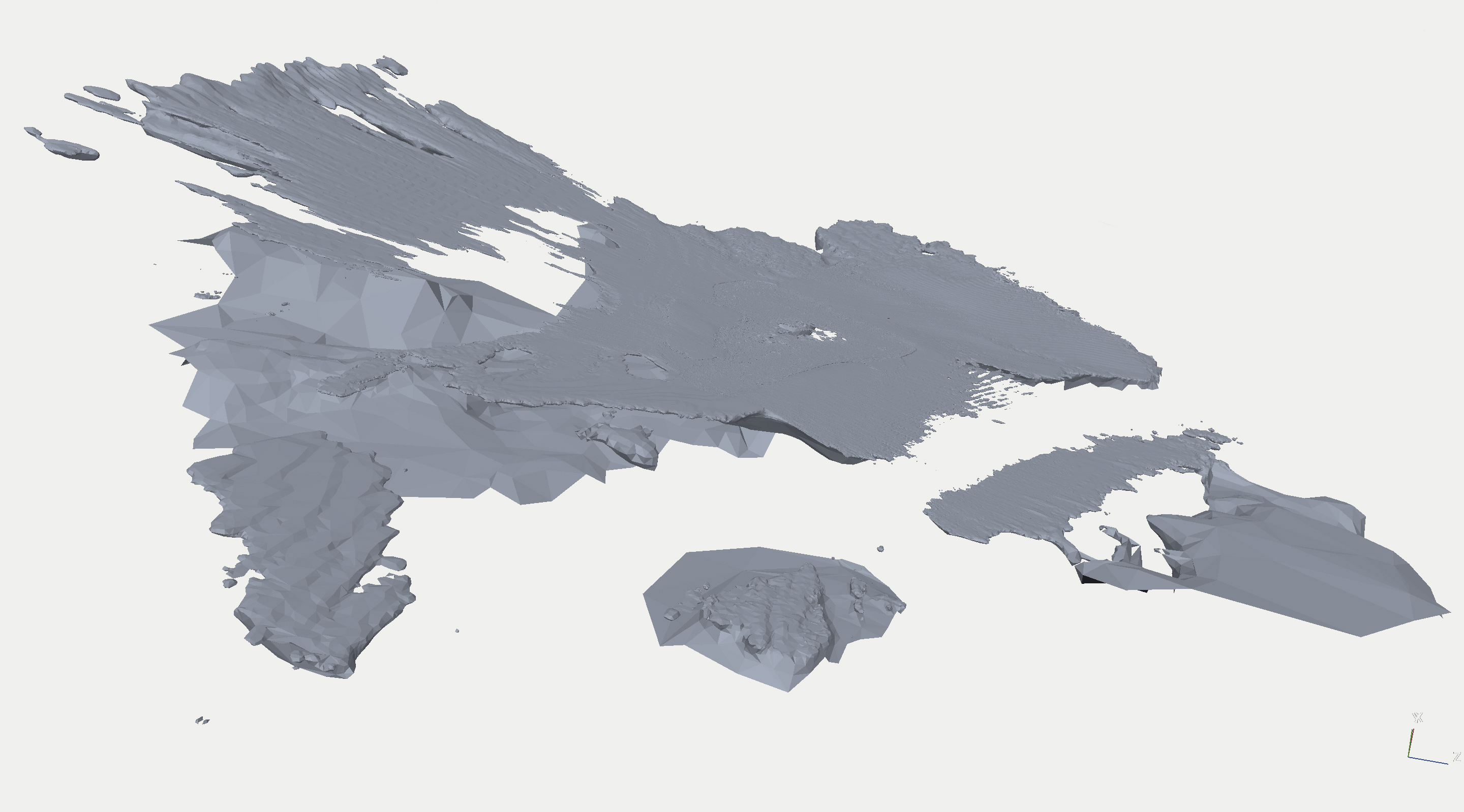
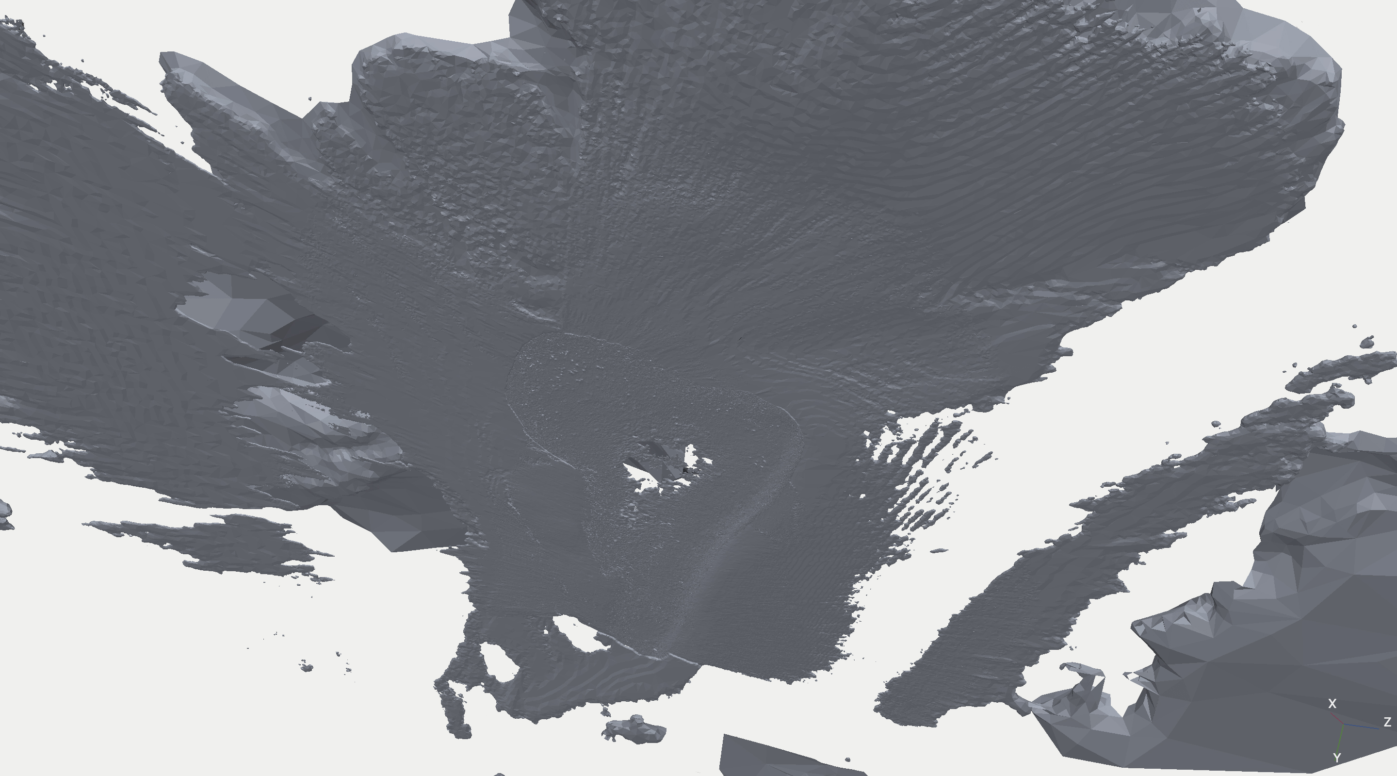
To refine a digital geographical representation, I employed photogrammetry as a measuring device to record tidal changes while walking within the tidal zone. However, the optical performance of the scanning process was disrupted by fluctuating reflections from the river’s surface. As a result, the documentation unexpectedly revealed a hidden, virtual island—an artificial geography generated by the machine’s interpretation of a glitch or blind spot in perceiving the dynamic boundary between water and land.
This phenomenon suggests how our landscapes, increasingly mediated by digital technologies, may become decontextualized and morphologically transformed through the entanglement of environmental and technological factors in the age of digitalization.
Humans and machines perceive reality based on their respective capacities. Both capacities generate individual versions of reality, each applying distinctive reading and data procession. While humans experience through sensual consciousness, computers assemble reality through algorithms, leading one to assume that reality is indeed, a subjective phenomena.
Does an outcome not match our perspective of reality, we often declare a machine-made recreation of reality as erroneous. By concentrating on these automated “malfunctions“, our environmental aesthetic is fundamentally reassessed as a result of probing into our perceptible reality. Therefore the project interrogates the boundaries between visible and invisible, tangible and intangible, ultimately what is real and what is unreal. It raises questions of humanity’s dependency on AI and wether machines have become an inevitable extension to the species.